Amorite resettlement
At ca. 1950 – 1900 BC the return of pre-2200 BC precipitation saw the still-unexplained resettlement of west Asian rain-fed domains, including the Khabur Plains. The Leilan Region Survey documents a ten-fold population increase over the Akkadian period with significant numbers now in small village settlements (Ristvet/Weiss 2005). Simultaneously, Tell Leilan was resettled under Šamši-Adad’s Amorite paramountcy as a new “hollow capital,” Šubat-Enlil (Weiss 1983a; Weiss 1983b; Weiss 1990a–c).
The new capital’s distinctive Acropolis temple façades and cylinder seal assemblage iconography represent the introduction of southern ‘Babylonian’ styles into northern Mesopo- tamia for legitimation of the new Amorite regional control, a tactic previously deployed in Leilan IIId times. The Building level 2 – 3 temples of the Leilan Acropolis are early examples of the architectural plan typical of Assyrian temples of the ninth and eighth centuries BC, with direct access entrance – wide room antecella – long room cella. A similar temple was constructed by Šamšī-Adad at Assur, and Assyrian temples of the 16th – 15th centuries BC follow this plan as well. Similar to Old Babylonian temples elsewhere, and following a tradition that extended back to the Uruk period in southern Mesopotamia, the Leilan temple façades were decorated with mud-brick semi-engaged columns fashioned to resemble, in intricate variety, the trunks of trimmed palm trees (Figs. 8, 9a, 9b): plain-faced large spirals, twisted in alternate directions; plain-faced, straight or twisted; mud-plaster sculpted into imbricated fronds with a smooth surface, with vertical pinnate hatching, or with step-like stages with vertical pinnate hatching and crosshatching; mud-plaster diamond-shaped frond scars, surrounded by braided columns; mud-plaster square, scale-like frond scars (Weiss et al. 1990).
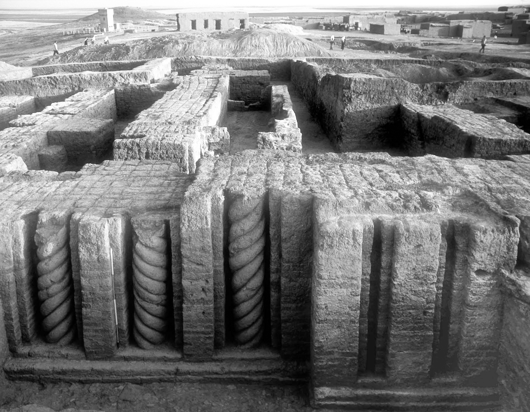
Fig. 8 L82, Acropolis Northeast, Pd. I Building Level II, north facade.
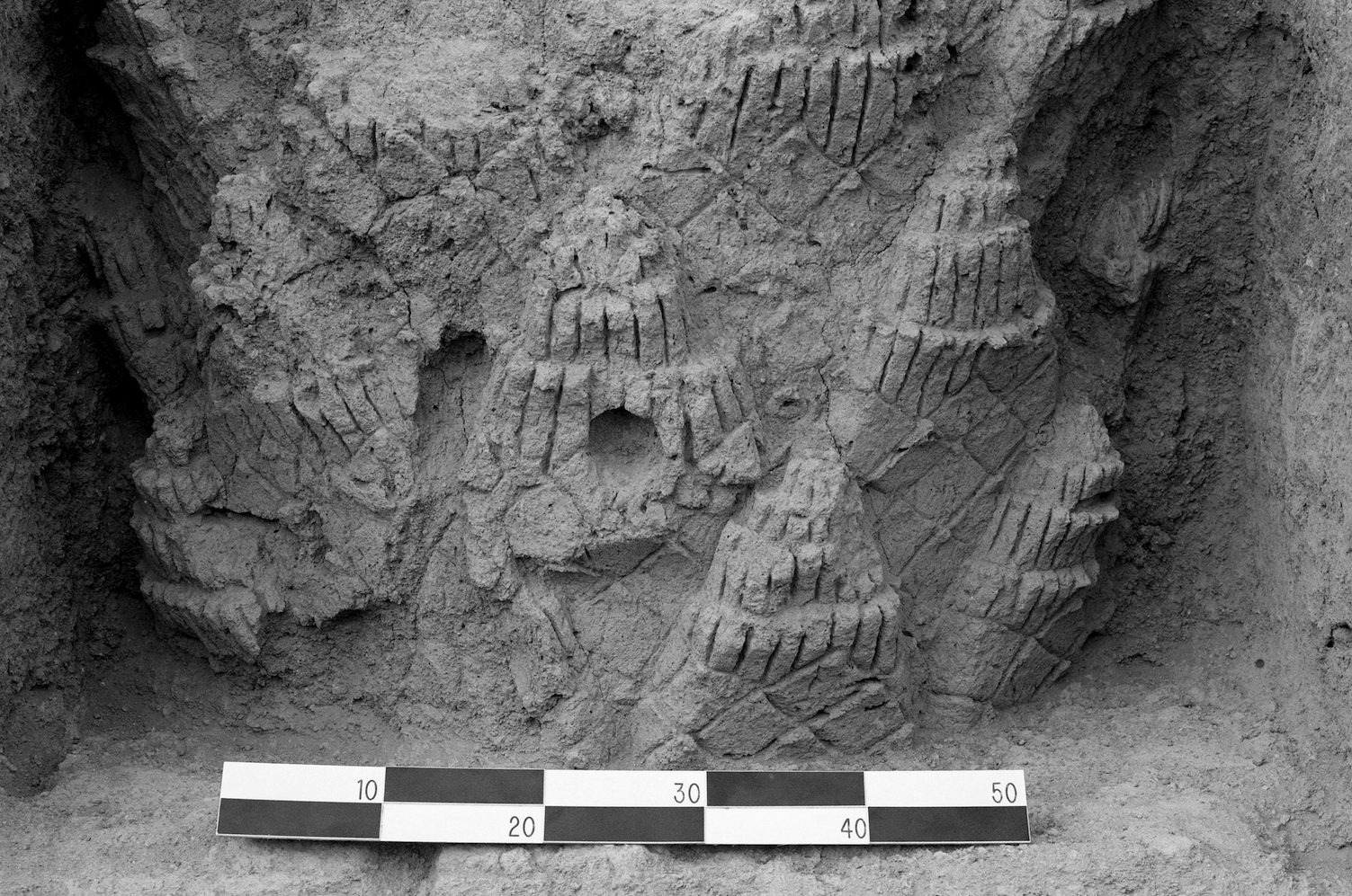
Fig. 9a L85, Acropolis northeast, Pd. I, Building Level II, south façade, west column.
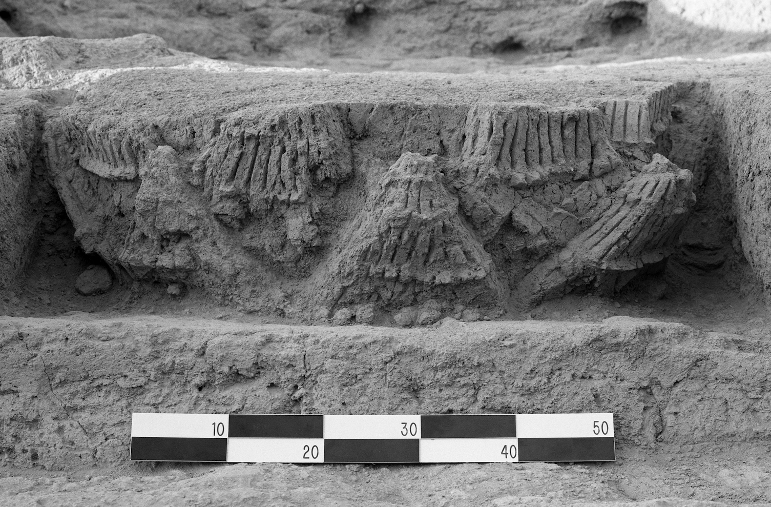
Fig. 9b L85, Acropolis northeast, Pd. I, Building Level II, south façade, east column.
The Building Level II temple rooms contained a fragment of a basalt stele inscribed with monumental Old Babylonian script and 20 administrative tablets and fragments, including grain ration distributions according to standard Šamšī-Adad period kina(macron)tu -measures. The sealings “Ṣuri-Adad, son of Zidriya, servant of Šamšī-Adad” lay upon the floor of rooms 12 and 13. Secondary renovations of the temple included a blocked doorway against which three sealings of Ṣuri-Adad were also retrieved and two seal impressions (L82-74, -75) of “Apil-ilišu son of Ali-banišu, servant of Turum-natki.” In room 8 were 227 complete and fragmentary sealings of “Beli-emuqi, servant of Haya-abum, servant of the god Adad.” All the sealings featured the period’s iconographic convention “god with mace facing supplicant goddess,” apart from the unique guilloche-decorated servant of the Turum-natki sealings. These sealings were the first excavation-retrieved linkages of Tell Leilan with ancient Šubat-Enlil (Weiss 1985a, b; Weiss et al. 1990; Parayre/Weiss 1991).
The Building Level “X” temple to the south, with only its foundations preserved, may have been linked to the Building Level II temple. If this was the case, then Building Level II and Building Level “X” encompassed ca. 6000 m. sq., twice the size of the Sîn Šamaš temple at ssur and of the temple at Tell ar-Rimah, and equivalent in size to the Assur temple at Assur. Ash and trash accumulated above the foundations, including portions of a Khabur ware associated administrative archive dated with limus from Šamšī-Adad’s reign (Whiting in Weiss et al. 1990).
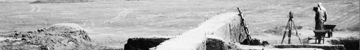
Šamšī-Adad’s palace at Šubat-Enlil was retrieved in part in 1985 and 1987 on the Lower Town East, but the excavated sample of 1000 square meters is less than 10% of the one-hectare rise that defines this building (Fig. 1)(Ristvet/Weiss 2011; Akkermans/Weiss 1991). Only three rooms of the earliest palace construction, Building Level 4, with seal impressions of servants of Išme-Dagan and Šamšī-Adad were retrieved, although Šamšī-Adad’s servants’ sealings were also deposited in rooms of Building Level 3, where the burnt floors across the extended exposure suggest violent destruction. This destruction can be associated with the well-documented region-wide turmoil following Šamšī-Adad’s death and seizure of Šubat-Enlil by the sukkalmaḫ of Elam, and shortly thereafter by Atamrum of Andarig.
Building Level 2 is associated with Himdiya of Andarig, Atamrum’s son. Here more than 600 royal letters and adminstrative texts and 300 tablet fragments and sealings were retrieved, including a copy of the Sumerian King List (Vincente 1995). One territorial treaty text within the archive, L87-1362, suggests localization of the post-Akkadian city of Nawar at Gir Nawaz, at the debouchment of the Jaghjagh onto the Khabur Plains, analogous to the location of Mozan/Urkeš 19 kilometers to the west (Matthews/Eidem 1993; Eidem 2011).
The abandoned palace ruins subsequently sheltered temporary occupants only briefly. A partially contemporary second palace, the Lower Town Palace North, was built for Qarni-Lim of Andarig, perhaps as his embassy. Among twelve palace rooms surrounding a courtyard, the Room 12 floor was littered with the 647-tablet beer archive of Šamaš-dayyān, a servant of Qarni-Lim, originally stored within four small jars (Weiss 1991; Van de Mieroop 1995; Weiss 1996; Pulham 2000). After ca. 1700 BC, and the Leilan palace and temple abandonments, regional occupation declined, for reasons unknown, until the 15th century resettlement around 167-hectare Tell Farfara (Leilan Region Survey site 186), perhaps the Mitanni capital Waššukanni. The size of this Mitanni period city challenges many archaeological assumptions about ancient dry-farming productivity, settlement distributions and urban sizes, and land transport efficiencies.